The project was concentrating upon the development of a robust radar sensor, which is specially designed to be carried by a low payload TUAV (Tactical UAV) and the development of signal processing algorithms suited to cope with the unstable flight conditions for such an airborne vehicle. In addition the demonstrated system can also be used for civilian applications like surveillance of traffic infrastructure or the monitoring of major events.
The project was concentrating upon the development of a robust radar sensor, which is specially designed to be carried by a low payload TUAV (Tactical UAV) and the development of signal processing algorithms suited to cope with the unstable flight conditions for such an airborne vehicle. In addition the demonstrated system can also be used for civilian applications like surveillance of traffic infrastructure or the monitoring of major events.
Objective
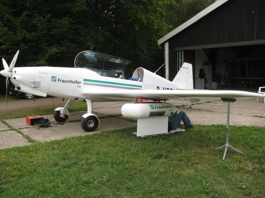
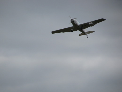
Airborne surveillance of civilian traffic ways and any other large scale human activities or environmental changes is one driver for the development of UAVs. Military applications even more demand reconnaissance from airborne platforms. For different operational purposes different classes of UAVs have been developed. Of special importance for the troop leader in the field are tactical UAVs (TUAVs) even downscaled in size. The all-weather capability of the sensors on board such vehicles is an important requirement. The recent deployment scenarios, often in desert or arid environment, refer not only to bad weather but also to the ability to look through dust clouds and sand storms. The only sensor, which is capable to cope with such environmental restrictions and is able to deliver high resolution images, is the Synthetic Aperture Radar. The proposed work will concentrate upon the development of a miniaturized and high resolution millimetre wave radar sensor, which is specially designed to be carried by a low payload TUAV and the development of signal processing algorithms suited to cope with the unstable flight conditions for such an airborne vehicle.
Trends
Innovative system design with new radar processing for military and civilian application.
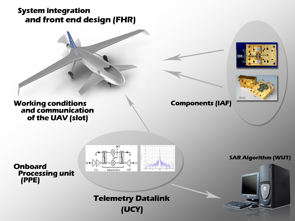
The proposal SARape - Synthetic Aperture Radar for all weather penetrating UAV application concentrates on the development of a new real time SAR algorithm with high resolution. Because this algorithm needs a platform supplying raw data which can be processed to gain the high resolution. So a miniaturized broad band SAR sensor operating at a centre frequency of 94 GHz with slotted array antennas has to be developed. The proposal includes the design of small sized radar together with a pre-processing unit based on the aircraft as well as a new high speed digital data transmission unit used to send the pre-processed data to ground station. The new concept using a broadband digital data transmission line is inevitable to combine raw data and telemetry data for synchronized data processing. The ground station, which is built up from COTS hardware will operate an algorithm also developed and implemented in this project to process the transmitted data stream online to SAR images with high resolution and quality. This system design in combination with the proposed processing allows military and civilian user to detect, locate and identify moving targets from an airborne platform in all environment conditions. Because of the very high flexibility of the data link the system allows to extent to multiple airborne platforms in future.
Project overview
Radar for UAVs:
Digital transmission:
Real time SAR processor:
Evaluation of usable UAVs: